The kick-assness of the trail stems from its mystique. This trail came about in the 19th century. Basically, it is a collection of a number of contiguous trails, winding through the charcoal forests covering this area. These trails connected the various iron forges and charcoal furnaces in this part of Pennsylvania which were in operation during that period. When you think of a trail, usually you think of walking through wilderness, forests, mountains and streams. While this trail does all that, since it is such a long continuous trail, it also passes through populated areas, frequently passing between two houses in a suburban neighbourhood, sometimes hugging fences, sometimes even following paved roads. That is what's so interesting about this trail, the fact that you can just walk onto private property along a home and all the homeowner can do is glare at you through his window, maybe even aim a rifle at you, but cannot shoot you, since you are on a public trail. Gives one a lot of mental satisfaction. But that's just me.
I parked my car in the Valley Forge National Historic Park, the site of George Washington's winter camp during the time of the American Revolution after the British overran Philadelphia, which was, then, the colonial capital. Here, Washington spent the winter mulling over the possibility of attacking the British at Philadelphia, encamped at this strategic location on the banks of the Schuylkill river.
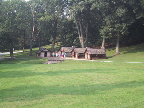
This park has a number of old huts which the original revolutionaries had barracked in, as well as earthen bulwarks and defenses.
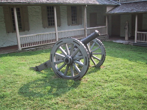
This cannon was sitting outside a house that used to be Washington's headquarters.
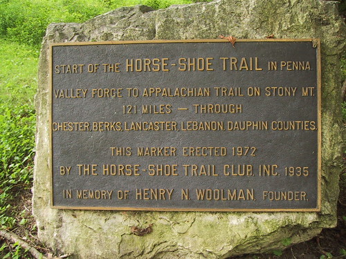
I started the trail at this marker which officially designates the beginning of the trail. For the first mile, the trail climbs up the side of the curiously named Mount Misery. On the other side of the Valley creek stands Mount Joy. The Horseshoe trail guide book explains 'Two men of an exploring party camped on the banks of the Schuylkill river and got lost on a nearby hill. After stumbling and groping all night on this "miserable" hill, they crossed the creek at dawn and ascended another hill. From the top, they could see "with joy" the camp of their party. To match their experiences, they named the two hills Mt Misery and Mt Joy respectively.' The guide book does not specify, however, whether the source of their misery was the stumbling or the "groping".
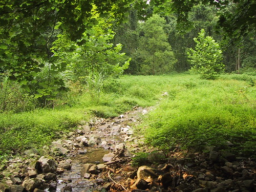
On the way up Mt Misery, I passed this little stream running down the hill. It was called Colonial Springs, and it apparently originates somewhere on top of Mt Misery.
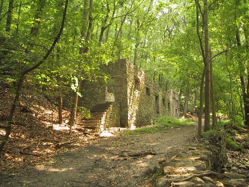
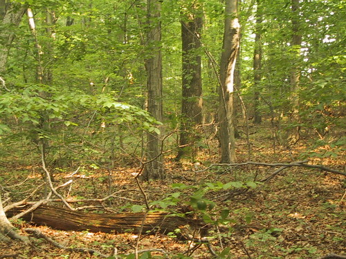
Halfway up Mt Misery, there appeared suddenly this dilapidated ruin of a house. As I walked up to it, I could hear the sound of rushing water and I wondered whether the former residents had forgotten to turn off the tap before abandoning it. In fact, I could now see water running out through the front door. Later, I would come to know that this place used to be a bottling plant, established in 1800, called the "Colonial Springs Bottling Company". Back then, it used to bottle water from the natural spring now flowing unimpeded through the house and supply it to the city of Philadelphia. Interesting.
On reaching the top of Mt Misery, I found myself in some woods with houses with fences on both sides of the trail. On closer inspection, the fence announced itself to be electrified. That was pretty "shocking". Ha ha .. puke.
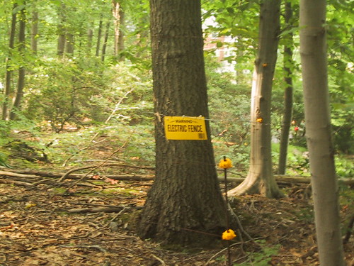
The guide book had warned me that I might find electrified fences along the way, but I had brushed it off, thinking they were just trying to get people not to trespass on private property. Who were these fences trying to electroshock anyways? Burglars? Deer? Hikers? A short distance ahead, a fence was emitting a regularly spaced clicking noise as if some half-witted insect had bumped into it, gotten electroshocked and yet kept coming back for more.
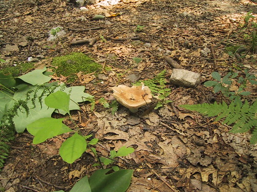
I saw a lot of these humongous mushrooms / toadstools in the area. Must have been something in the water. Or the soil. I wondered if the people living here were gigantic too.
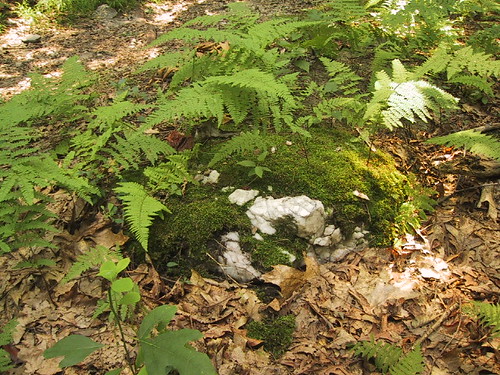
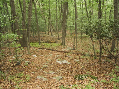
On this section of the trail, I saw these numerous marble outcroppings with moss growing on them, jutting out of the leaf-covered ground . Strange and beautiful. I heard some thrashing in the forest in front of me, then saw a couple of white-tailed deer run away. I was concerned they might run into the electrified fence. But then I realized it was their neighbourhood and they probably knew it better than I did.
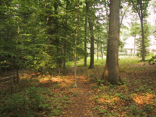
The trail then crossed a couple of roads before plunging into a residential neighbourhood. I was now weaving my way between houses, hugging fences, following telephone pole rights-of-way. Even though I knew I was not trespassing, it felt pretty strange, almost criminal.
As I was passing this one fence, I could hear sounds of barking on the other side of the fence coming my way. Pretty soon, the barking manifested itself into an enormous dog which was running directly at the fence with the obvious intention of jumping over it and mauling me. At the last minute, a woman's voice called out "Cappy", or it might have been "Caffy" and the dog paused in mid-attack, gave me a last lingering, regretful look and bounded back to it's owner. I continued on the trail, unmolested.
The trail then jumped out of the woods and became a paved road for the next mile or so. This road incidentally, was also called the Horseshoe Trail. Among the houses here, some were quite big and stunk of wealth, while some looked like mountain lodges, cozily nestling on the wooded bosom of Mt Misery.
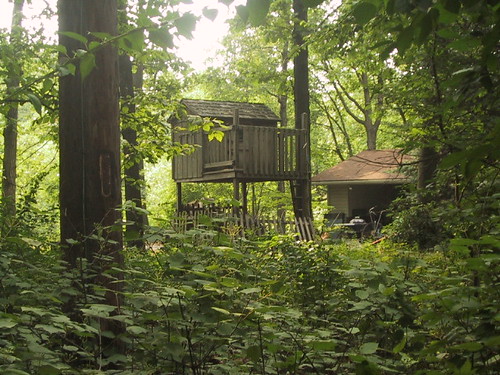
This house had a nice little wooden playhouse on its premises. I wish I had something like this growing up. I would probably have moved out of my real house and lived there fulltime.
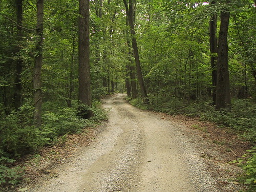
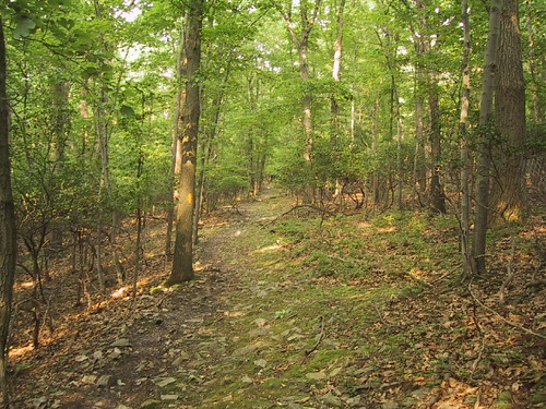
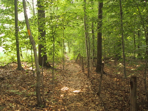
The road gradually turned into a dirt trail, then the houses disappeared and I was back in the woods again.
I continued for a while, till the trail again hit a road, where I decided to turn back. My legs were aching and I was starting to feel a bit hungry (Barbecue smells were wafting out of every freakin' house I passed) . On the way back, I again passed the house with the big dog. I could hear the woman calling out Cappy's name. Cappy, apparently, I surmised, was on the loose. Oh great. Not daring to make a sound, I tiptoed through the undergrowth, only commencing regular breathing after I had passed the godforsaken place. Stupid enormous terrifying Cappy.
While coming back, I saw some more deer and took a picture. There can you spot them? Actually I don't see them either. I took that picture long after all the deer had run away. Its goddamn hard to photograph running deer. They are very camera shy.
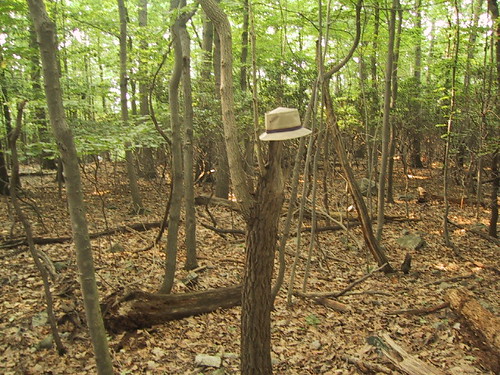
I then took a picture of myself standing under a tree. You can't see me because of my chameleon skin. Although you can see my hat. No, it's not hanging from the tree. That would be too obvious a trick.
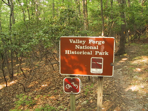
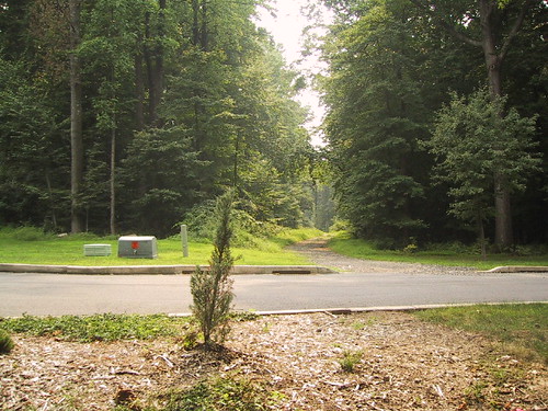
While coming back, I saw a sign I hadn't seen before. It said "no firearms". In my tired hazy state of mind, I couldn't help wondering if George Washington had ever considered putting up such signs all around his encampment to keep the heavily armed British out of the area. And whether the Brits would have obeyed those signs. After all, the Brits would have been as tired as I was no?
9 comments:
Gawker
Nice pix man. To keep the Brits out GW could have just posted huge 'Dentist Commune' signs. That would have done it. Will respond to ur Bush comment sometime later in the evening.
A question I have is how do u upload so many pictures on to the article ? Blogger would allow me only 4. And to add text I had to parse thru HTML code. It was not pretty. Any easier way that you can suggest ?
Sourin
Thanks man. As for picture uploading, I don't know .. I didnt have any problems with it. Maybe its your browser or something, I use Firefox btw. I could see the pictures as well as the text while I was editing the post.
Hi gawker:
Very nice pictures.
It reminds me that I need to take my son to a National Park before summer ends.
Thanks Michael. Yeah you should do that. Damn fast-moving summers.
That was an enjoyable post.....Although you can see my hat. No, it's not hanging from the tree. That would be too obvious a trick.
:-)
If you enjoy hiking, I think you will find some of the best hikes in the States on the west coast, in the Pacific Northwest (mostly Washington and Oregon; Olympic national park, and the Cascade mountains). Arizona/Utah has some great hikes also (bryce canyon, Zion national park etc). More than worth the visit.
nice post.... reminds me I need a holiday soon :)
Mt.Misery, what a name!
Thanks Sunil, Charu. Yeah, Sunil someday I'm gonna do a big fat tour of the West.
Charu, think about all the people who actually have houses and live on Mt Misery.
Thank you very much patrixsan. what to do.. no adventures happen to me during my hikes.
Ahh, fun - a nice hike report!
Post a Comment